
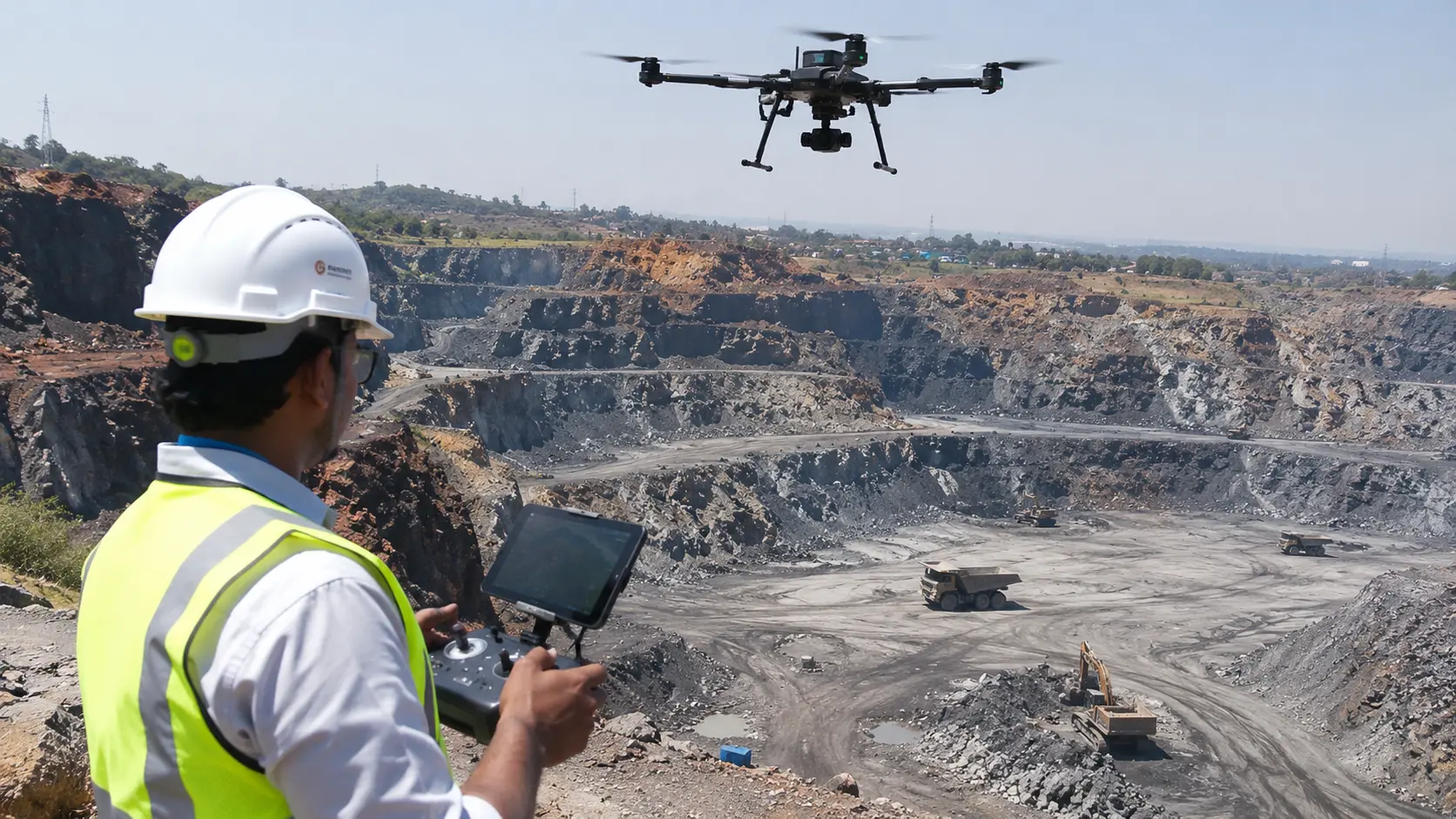
A drone mining survey uses unmanned aerial vehicles (UAVs) equipped with high-resolution cameras, LiDAR sensors or other specialised payloads to collect geospatial data across mining areas. The collected data can be processed into accurate maps, 3D terrain models, elevation datasets and stockpile volume reports.
Mining companies use drone surveying to monitor excavation progress, measure mineral stockpiles, map open-pit mines, inspect infrastructure and document changes across mining sites.
Compared with relying entirely on conventional ground measurements, drone surveys can provide a faster way to capture extensive areas and obtain detailed visual and spatial information. The appropriate survey method depends on the site, accuracy requirements and intended engineering application.
Looking for a drone mining survey partner? Explore Agmay's mining survey and geospatial solutions for mine mapping, stockpile volumetrics, LiDAR and RTK/PPK survey workflows.
What Is a Drone Mining Survey?
A drone mining survey is an aerial surveying process used to measure, map and monitor mining environments. A drone follows a planned flight path and captures overlapping images or laser measurements. These observations are processed using photogrammetry or LiDAR software to generate georeferenced survey outputs.
A professional mining drone survey can produce:
- High-resolution orthomosaic maps
- Digital Elevation Models (DEM)
- Digital Terrain Models (DTM)
- Digital Surface Models (DSM)
- 3D point clouds and terrain models
- Contour and topographic maps
- Stockpile volume calculations
- Cut-and-fill and excavation progress reports
- GIS datasets and mine boundary maps
These outputs help mine surveyors, engineers and operational teams understand the current condition of a mining site.
How Are Drones Used for Mining Surveys?
Drone technology supports several important mining activities.
1. Open-Pit Mine Mapping
Drones capture aerial imagery of open-pit mines, excavation areas, benches, haul roads and surrounding terrain. The collected information can be converted into orthomosaic maps and 3D terrain models.
Mining engineers can use these datasets for topographic analysis, mine planning, excavation monitoring and site documentation.
2. Stockpile Volume Measurement
Drone-based stockpile measurement is one of the most useful applications in mining.
Photogrammetry or LiDAR captures the visible surface of a stockpile and creates a 3D model. Surveyors then define the stockpile boundary and an appropriate base surface to calculate its volume.
This process can support inventory monitoring for materials such as coal, iron ore, limestone, bauxite and aggregates.
For estimated tonnage, the measured volume must be combined with a suitable bulk-density value.
3. LiDAR Surveying for Mining
LiDAR (Light Detection and Ranging) uses laser pulses to measure distances and generate detailed three-dimensional point clouds.
Drone LiDAR surveying can support complex terrain mapping, infrastructure surveys and applications where detailed surface information is required. Its suitability depends on sensor configuration, point density, vegetation and project specifications.
4. Mine Progress and Excavation Monitoring
Repeated drone surveys allow mining companies to compare site conditions across different dates.
By comparing terrain models, teams can analyse excavation changes, material movement, dumping activity and construction progress.
Cut-and-fill analysis can also help estimate differences between an existing surface and a reference or design surface.
5. Mine Boundary and Environmental Monitoring
Georeferenced aerial maps and GIS datasets can help monitor mining lease areas, surrounding land, access routes and rehabilitation activities.
Comparing updated imagery with previous survey data can help identify visible changes and potential encroachment requiring further investigation.
Drone-derived information should be checked against authoritative lease and cadastral records where legal boundary decisions are involved.
Drone Photogrammetry vs LiDAR for Mining
The choice between photogrammetry and LiDAR depends on the mining environment and required survey outputs.
| Feature | Photogrammetry | LiDAR |
|---|---|---|
| Data collection | Overlapping photographs | Laser measurements |
| Main output | 3D models and orthomosaics | Detailed 3D point clouds |
| Typical applications | Open-pit mapping and stockpiles | Terrain and complex surface mapping |
| Vegetation | Limited ground visibility under dense vegetation | May capture ground returns beneath vegetation, depending on conditions |
| Considerations | Image quality, lighting and surface texture | Sensor configuration, point density and processing |
Both technologies can support mining surveys. The right solution should be selected based on terrain, vegetation, required accuracy, deliverables and project budget.
What Accuracy Can a Drone Mining Survey Achieve?
Drone survey accuracy depends on several factors:
- Drone camera or LiDAR sensor quality
- Flight altitude and image resolution
- RTK or PPK positioning
- Ground Control Points (GCPs)
- Coordinate reference system
- Terrain and environmental conditions
- Data processing and independent validation
RTK and PPK workflows can improve georeferencing, but they do not automatically guarantee a particular level of survey accuracy.
For engineering and commercial applications, the survey specification should define the required horizontal and vertical accuracy. Independent checkpoints should be used to evaluate the final results.
Drone Mining Survey Requirements in India
Drone surveying has an important role in India's mining-monitoring framework.
Rule 34A of the Mineral Conservation and Development Rules, 2017, introduced drone-survey and digital aerial-image submission provisions for specified mining leaseholders. The published rule includes thresholds linked to an annual excavation plan of one million tonnes or more, or a leased area of 50 hectares or more.
The Indian Bureau of Mines has also published a Standard Operating Procedure covering survey planning, drone specifications, ground control, coordinate systems, output formats and data submission.
In August 2025, the Ministry of Mines reported that 3,852 digital aerial images had been submitted through the Drone Data Management System during the preceding three years.
Mining operators should check the latest applicable rules, amendments and IBM instructions before arranging a compliance survey.
Official references
- Indian Bureau of Mines: Drone Survey Standard Operating Procedure
- Mineral Conservation and Development Rules, 2017
What Should a Mining Drone Survey Deliver?
A professional survey should provide more than aerial photographs. Deliverables should be agreed before the flight and matched to the mining company's technical requirements.
Typical outputs include:
- Georeferenced orthomosaic imagery
- DEM, DTM and DSM datasets
- Contour and topographic maps
- Classified point clouds
- 3D terrain models
- Stockpile volume and tonnage estimates
- Cut-and-fill analysis
- GIS and CAD-compatible files
- Survey methodology and accuracy reports
The exact deliverables depend on the survey objective and project specification.
Choosing a Drone Mining Survey Company
Before selecting a drone surveying provider, mining companies should evaluate:
- Mining survey experience: Does the provider understand mine terrain, stockpiles, excavation and operational requirements?
- Equipment and sensors: Can the provider select appropriate RGB, RTK/PPK or LiDAR equipment?
- Survey accuracy: Does the provider define accuracy requirements and validate results using checkpoints?
- Data processing: Can the team generate usable orthomosaics, terrain models, point clouds and volumetric reports?
- Regulatory knowledge: Does the provider understand applicable mining survey procedures and submission requirements?
- Reporting and support: Can the provider deliver organised datasets and technical reports for engineering and operational teams?
A reliable provider should explain the survey methodology, limitations, accuracy validation and expected deliverables before deployment.
Drone Mining Survey Services by Agmay Technologies
Agmay Technologies provides drone-based surveying, mapping and geospatial solutions for mining applications.
Our mining-focused capabilities include:
- Drone topographic surveying and mine mapping
- Open-pit mine and quarry mapping
- Stockpile volume measurement and volumetric analysis
- LiDAR-based terrain and surface mapping
- DEM, DTM and DSM generation
- RTK/PPK survey workflows
- GIS mapping and geospatial data processing
- Mine progress and site-change monitoring
- 3D modelling and digital twin workflows
We focus on converting drone-captured information into useful geospatial datasets that support mining surveys, operational monitoring and engineering decisions.
Looking for a drone mining survey solution? Visit Agmay Technologies' Mining Survey Services to explore our capabilities and discuss your project requirements.
Planning a drone mining survey?
Discuss your mine area, survey objective, required accuracy and expected deliverables with Agmay Technologies.
Explore Mining Survey Services ↗Conclusion
Drone mining surveys are helping mining companies collect detailed spatial information for mine mapping, stockpile measurement, excavation monitoring and operational planning.
With technologies such as photogrammetry, LiDAR, RTK/PPK and GIS, drone surveying can turn aerial data into practical engineering and geospatial deliverables.
For mining companies evaluating modern surveying solutions, selecting the right equipment, survey methodology and data-processing workflow is essential.
Explore Agmay Technologies' drone mining survey and geospatial solutions to discuss your mining survey requirements.
Frequently Asked Questions
What is a drone mining survey?
A drone mining survey uses an unmanned aerial vehicle equipped with cameras or specialised sensors to collect geospatial data over a mining site. The data is processed into maps, 3D models, elevation datasets and volume reports.
How are drones used in mining?
Drones are used for mine mapping, stockpile measurement, excavation monitoring, topographic surveying, infrastructure inspection, boundary monitoring and environmental documentation.
Can drones calculate stockpile volume?
Yes. Photogrammetry or LiDAR data can be used to create a 3D stockpile surface. A surveyor calculates the volume using a defined boundary and appropriate base surface.
Is LiDAR better than photogrammetry for mining surveys?
Neither is universally better. Photogrammetry is useful for many open-area mapping and stockpile applications, while LiDAR can be advantageous for detailed point-cloud and terrain mapping. The selection depends on site conditions and required outputs.
Are drone surveys mandatory for mines in India?
Rule 34A of the MCDR, 2017 establishes drone-survey and digital-image submission provisions for specified categories of mining leaseholders. Operators should verify the current applicable requirements with the Indian Bureau of Mines.
How often should a mine conduct a drone survey?
Survey frequency depends on excavation activity, stockpile movement, monitoring objectives and applicable regulatory requirements. Mining operators may schedule periodic stockpile surveys, progress surveys and annual compliance-related surveys.
What is the difference between a drone mining survey and a traditional mine survey?
Drone surveys capture extensive aerial imagery and surface information, while conventional ground surveys provide direct measurements at selected locations. Both methods are complementary and may be combined to achieve the required accuracy.