
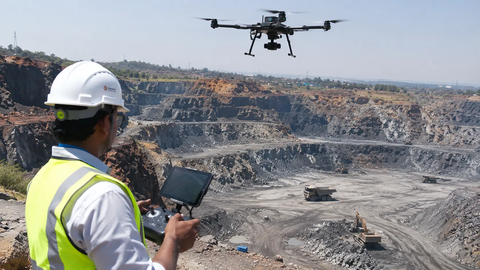
The mining industry is entering a new era of digital transformation. As mining operations become larger and more complex, companies are adopting advanced technologies to improve productivity, monitor mining sites, manage resources and make better operational decisions.
One of the technologies playing an increasingly important role in this transformation is drone mining.
Mining drones are changing how mining companies collect site information, inspect infrastructure, measure stockpiles, monitor excavation activities and understand their operational environments. Equipped with high-resolution cameras, LiDAR sensors, thermal imaging systems and advanced positioning technology, drones can capture valuable information from areas that may be difficult or time-consuming to inspect using conventional methods.
From large open-pit mines and underground mine entrances to quarries, mineral processing facilities and material storage yards, drone technology offers a flexible approach to collecting aerial data and supporting mining operations.
More importantly, modern mining drones are no longer limited to aerial photography. They can generate detailed maps, three-dimensional models, elevation data and analytical outputs that help mining teams understand what is happening across their sites.
At Agmay Technologies, we combine drone technology with geospatial mapping, LiDAR, 3D modelling and digital mining intelligence to support the evolving requirements of the mining industry.
Looking for a drone mining partner? Explore Agmay's drone mining solutions for aerial surveying, LiDAR, stockpile volumetrics, inspection and mining intelligence.
What Is Drone Mining?
Drone mining refers to the use of unmanned aerial vehicles (UAVs) and specialised drone technologies to support mining operations.
These drones collect aerial imagery, geospatial information and sensor measurements that can be processed into useful information for mining engineers, surveyors, geologists, safety teams and operational managers.
A mining drone can be equipped with different payloads depending on the task.
For example:
- High-resolution cameras for aerial mapping and site documentation.
- LiDAR sensors for three-dimensional terrain mapping.
- Thermal cameras for selected industrial inspections.
- Multispectral sensors for environmental and vegetation monitoring.
- Magnetometers for specialised airborne geophysical surveys.
- RTK and PPK positioning systems for improved georeferencing.
The information collected by these systems can help mining companies monitor their sites, analyse changes and maintain updated digital records.
In simple terms, drone technology allows mining companies to collect information from above and turn it into actionable operational intelligence.
How Are Drones Used in the Mining Industry?
Drones have applications across several areas of mining. Their role depends on the type of mine, operational requirements, terrain and the sensors used.
1. Mine Surveying and Aerial Mapping
Mine surveying is one of the most established applications of drone technology.
Mining sites often cover large geographical areas with constantly changing terrain. Keeping maps updated through conventional ground surveys can require considerable fieldwork.
Drones equipped with high-resolution cameras can capture overlapping aerial photographs that are processed into geographically referenced maps and three-dimensional models.
Drone mine surveying can support:
- Open-pit mine mapping.
- Quarry surveys.
- Mine boundary documentation.
- Terrain and elevation mapping.
- Haul road mapping.
- Excavation area mapping.
- Infrastructure mapping.
- Periodic site surveys.
The resulting information helps mining teams maintain a better understanding of their operational areas.
2. Stockpile Measurement and Volume Calculation
Mining companies handle large quantities of materials such as coal, iron ore, limestone, bauxite, sand and aggregates.
Knowing how much material is stored at a particular location is important for inventory management, production planning and commercial reporting.
Drone-based stockpile measurement provides a way to capture the three-dimensional surface of stored materials.
Using photogrammetry or LiDAR, the collected information can be processed to calculate stockpile volumes.
Applications include:
- Coal stockpile measurement.
- Iron ore volume calculation.
- Limestone inventory monitoring.
- Aggregate stockpile measurement.
- Material quantity estimation.
- Periodic inventory comparison.
- Production reconciliation.
The measured volume can also be converted into an estimated tonnage when an appropriate material density is available.
3. Mining Site Inspection
Mining operations involve several types of industrial infrastructure that require regular inspection.
Some structures are difficult to access because of their height, location or operating conditions.
Drones equipped with high-resolution cameras can capture images of selected assets and structures for visual inspection.
Common applications include:
- Conveyor belt inspection.
- Crusher inspection.
- Processing plant documentation.
- Electrical infrastructure inspection.
- Industrial structure assessment.
- Access road inspection.
- Equipment condition documentation.
Thermal imaging can provide additional information for suitable inspection tasks by identifying temperature variations in selected equipment.
Drone inspection can reduce the need for personnel to physically access certain locations for initial visual assessments. It does not replace specialist maintenance inspections where physical testing is required.
4. Open-Pit Mine Monitoring
Open-pit mining involves continuous changes to the terrain as excavation and material extraction progress.
Drones can collect updated aerial information to help mining teams observe these changes.
By comparing surveys collected at different times, operators can monitor changes in excavation areas, benches, haul roads and stockpile locations.
Applications include:
- Excavation progress monitoring.
- Pit mapping.
- Bench documentation.
- Terrain change detection.
- Cut-and-fill analysis.
- Site development monitoring.
- Mine planning support.
Repeated drone surveys provide digital records that can support engineering and operational reviews.
5. Mining Safety and Slope Monitoring
Safety is a major consideration in mining environments.
Steep slopes, unstable ground, difficult terrain and heavy machinery can create risks for personnel working on site.
Drones can help collect aerial information from selected areas without requiring survey teams to enter every location physically.
They can support:
- Slope condition observation.
- Bench inspection.
- Hazard-zone documentation.
- Terrain change monitoring.
- Tailings facility visual inspections.
- Access route assessment.
- Emergency site documentation.
Repeated aerial data collection can help teams observe changes that may require further investigation.
Drone imagery and terrain models are supporting information; they should not be treated as a replacement for geotechnical instrumentation, engineering analysis or formal safety assessments.
6. Mineral Exploration and Geological Mapping
Drone technology is also finding applications in mineral exploration.
Specialised UAV platforms can carry sensors designed to collect geological and geophysical information.
Depending on the project, these may include:
- High-resolution RGB cameras.
- Multispectral imaging systems.
- Hyperspectral sensors.
- Magnetometers.
- LiDAR systems.
These technologies can support geological mapping, surface mineral alteration studies, terrain assessment and specialised airborne geophysical surveys.
For example, airborne magnetic measurements can help geophysicists investigate variations in the Earth's magnetic field and identify geological features that require further investigation.
Drone-based exploration data must be interpreted by qualified specialists and validated using appropriate ground-based exploration methods.
7. Environmental Monitoring in Mining
Environmental management is an important part of responsible mining operations.
Mining companies need to monitor land conditions, vegetation, drainage systems and rehabilitation activities.
Drone imagery and suitable remote-sensing payloads can help collect updated environmental information.
Applications include:
- Vegetation monitoring.
- Mine rehabilitation documentation.
- Land-use change assessment.
- Erosion observation.
- Drainage mapping.
- Water body documentation.
- Environmental site reporting.
Multispectral imagery can provide additional information about vegetation characteristics, depending on the sensor and analysis methodology.
8. Mining Boundary and Site Security Monitoring
Mining leases and operational sites can cover extensive geographical areas.
Monitoring these areas through ground inspections alone can be challenging.
Drone imagery combined with GIS boundary information can help mining companies document their operational areas and observe selected changes.
Applications include:
- Lease boundary visualisation.
- Unauthorised excavation observation.
- Encroachment documentation.
- Site access monitoring.
- Material movement documentation.
- Aerial security inspections.
Drone operations for security purposes should follow applicable privacy, aviation and site-security requirements.
9. Mining Infrastructure and Haul Road Mapping
Mining operations depend on infrastructure such as haul roads, access routes, conveyors, processing facilities and storage areas.
Drone mapping can help maintain updated digital representations of this infrastructure.
These datasets can support:
- Road condition documentation.
- Route planning.
- Infrastructure layout mapping.
- Construction progress monitoring.
- Facility expansion planning.
- Site development documentation.
Updated aerial maps help operational teams understand the relationship between different facilities and working areas.
Types of Mining Drones
Not every drone is suitable for mining operations. The right platform depends on the survey area, flight duration, payload requirements, terrain and data collection objectives.
1. Multirotor Mining Drones
Multirotor drones are commonly used for mapping, inspection and aerial documentation.
They can take off and land vertically and can operate in relatively confined areas, depending on the site conditions.
Common applications include:
- Stockpile surveys.
- Infrastructure inspection.
- Quarry mapping.
- Small and medium-sized site surveys.
- Industrial inspections.
Their flexibility makes them useful for a variety of mining-related tasks.
2. Fixed-Wing Drones
Fixed-wing drones are designed for efficient forward flight and can cover larger areas in suitable operating conditions.
They are useful for projects that require extensive aerial coverage.
Potential applications include:
- Large mine site mapping.
- Regional terrain surveys.
- Extensive exploration areas.
- Large-scale environmental mapping.
Some fixed-wing platforms require specialised launch and recovery arrangements.
3. VTOL Drones
Vertical Take-Off and Landing (VTOL) drones combine vertical take-off capabilities with efficient fixed-wing flight.
They can be useful when a project requires larger-area coverage but has limited space for conventional runway-style launch and landing.
4. LiDAR-Equipped Mining Drones
LiDAR-equipped drones use laser sensors to capture three-dimensional information about terrain and structures.
They can support:
- Terrain modelling.
- Elevation analysis.
- Detailed point cloud generation.
- Infrastructure mapping.
- Selected vegetation-covered terrain surveys.
The suitability of LiDAR depends on the sensor configuration, operating environment and project requirements.
5. Specialised Industrial Inspection Drones
Industrial inspection drones may carry high-resolution zoom cameras, thermal sensors or other specialised payloads.
They are used for selected inspection activities across mining infrastructure and processing facilities.
The platform and payload should always be selected according to the inspection objective.
Technologies That Make Modern Mining Drones Powerful
Modern drone mining systems combine multiple technologies to turn aerial data into useful information.
Photogrammetry
Photogrammetry uses overlapping aerial photographs to reconstruct three-dimensional surfaces.
It can generate:
- Orthomosaic maps.
- Point clouds.
- Digital Surface Models.
- Three-dimensional terrain models.
- Stockpile volume datasets.
LiDAR Technology
LiDAR uses laser pulses to collect three-dimensional measurements.
It is particularly useful for projects that require detailed elevation information or suitable terrain mapping under vegetation.
RTK and PPK Positioning
Real-Time Kinematic and Post-Processed Kinematic positioning technologies can improve the georeferencing accuracy of drone-collected datasets.
Their performance depends on equipment configuration, correction data, survey control and quality assurance.
Thermal Imaging
Thermal cameras detect differences in surface temperature.
In mining operations, they can support selected inspections of electrical equipment, industrial components and other suitable assets.
Multispectral and Hyperspectral Imaging
These sensors capture information across selected or numerous wavelength bands.
They can support vegetation analysis, surface material assessment and specialised mineral exploration studies.
GIS and Geospatial Analytics
Geographic Information Systems allow mining organisations to manage, visualise and analyse spatial information.
GIS can bring together maps, survey data, site boundaries, infrastructure and monitoring information.
Artificial Intelligence and Data Analytics
AI-based processing can support automated feature identification, image classification, change detection and other analytical tasks.
These systems can help teams process large volumes of data, although outputs should be validated before being used for operational decisions.
Benefits of Using Drones in Mining
Drone technology can provide mining companies with several operational advantages.
Improved Site Visibility
Aerial imagery gives mining teams a broader understanding of their operational environment.
They can observe excavation areas, stockpiles, roads, infrastructure and surrounding land from a single aerial perspective.
More Efficient Data Collection
Drones can collect information across large areas through planned missions.
For suitable projects, this can reduce the fieldwork required for certain mapping and inspection tasks.
Better Stockpile Management
Three-dimensional stockpile models can support volume calculation, inventory monitoring and periodic material comparisons.
Improved Inspection Access
Drones can capture information from selected difficult-to-access locations, reducing the need for personnel to enter those areas for routine visual data collection.
Updated Digital Records
Repeated drone surveys provide digital records that can be compared across different dates.
This helps mining teams document site changes and maintain historical information.
Better Planning and Decision Support
Combining drone imagery, elevation models and geospatial analysis can provide additional information for engineering and operational planning.
Support for Environmental Management
Drone-based monitoring can help document land conditions, vegetation and rehabilitation progress.
Drone Mining vs Traditional Mining Survey Methods
Drone technology does not eliminate the need for traditional surveying. Both approaches have different strengths and can complement each other.
| Parameter | Traditional methods | Drone-based methods |
|---|---|---|
| Data collection | Ground-based measurements | Aerial imagery and sensors |
| Site coverage | Depends on field access | Planned aerial coverage |
| Stockpile measurement | Ground measurements and modelling | 3D surface reconstruction |
| Terrain mapping | Survey instruments | Photogrammetry and LiDAR |
| Site visualisation | Drawings and survey data | Orthomosaics and 3D models |
| Repeat monitoring | Repeat field surveys | Repeat aerial missions |
| Difficult terrain | May require physical access | Can collect selected data remotely |
| Inspection | Ground-based visual inspection | Aerial visual documentation |
The best approach depends on the required measurement accuracy, site conditions, regulations and intended use of the information.
How Does a Drone Mining Survey Work?
A professional drone mining project typically follows a structured process.
1. Project Assessment
The team identifies the mining site, survey objectives, operational requirements and expected deliverables.
2. Equipment Selection
A suitable drone platform and sensor payload are selected according to the project.
3. Flight Planning
The survey area, flight routes, altitude, overlap, positioning requirements and operating conditions are planned.
4. Data Acquisition
The drone collects aerial imagery or sensor measurements according to the approved mission plan.
5. Data Processing
The collected information is processed using suitable photogrammetry, LiDAR or geospatial software.
6. Quality Control
The datasets are checked for completeness, positioning quality and suitability for the intended purpose.
7. Analysis and Reporting
The processed data is converted into maps, models, measurements and other agreed deliverables.
8. Operational Integration
The final outputs can be shared with engineering, survey, planning and management teams for further use.
Applications of Drone Mining Across Different Mining Types
Drone technology can be adapted to different mining environments.
Coal Mining
- Coal stockpile measurement.
- Open-pit mine mapping.
- Excavation monitoring.
- Infrastructure inspection.
- Site documentation.
Iron Ore Mining
- Mine terrain mapping.
- Stockpile volumetric analysis.
- Mining infrastructure mapping.
- Site monitoring.
- Geological mapping support.
Limestone Mining
- Quarry mapping.
- Excavation documentation.
- Material stockpile measurement.
- Terrain analysis.
- Environmental monitoring.
Bauxite Mining
- Terrain mapping.
- Land condition assessment.
- Excavation monitoring.
- Environmental documentation.
Granite and Stone Quarries
- Quarry site mapping.
- Stockpile volume calculation.
- Slope observation.
- Excavation progress monitoring.
Sand and Aggregate Mining
- Aggregate stockpile measurement.
- Site boundary mapping.
- Material inventory monitoring.
- Quarry terrain modelling.
Drone Mining in India: Growing Adoption of Digital Mining Technology
India's mining sector is increasingly adopting digital technologies to improve monitoring, documentation and operational management.
The Ministry of Mines has recognised the use of drone and satellite-based digital aerial imagery for monitoring mining activities under the regulatory framework.
The Government of India has also described the development of a Drone Data Management System for online submission of digital aerial images.
These developments demonstrate the growing importance of aerial data in mining supervision and digital mining workflows.
For mining organisations operating in India, drone technology can support site mapping, stockpile monitoring, terrain documentation and other operational requirements, subject to the applicable regulatory provisions.
Source: Government of India, Ministry of Mines, Lok Sabha response on AI-based mining, 6 August 2025.
Drone Mining Regulations and Compliance in India
Drone operations in mining environments must follow applicable aviation regulations, site permissions and relevant mining requirements.
Before conducting a drone mining survey, organisations should consider:
- Applicable Digital Sky requirements.
- Drone category and operational permissions.
- Airspace restrictions.
- Required pilot qualifications.
- Site-specific safety procedures.
- Landowner or mine operator permissions.
- Applicable Indian Bureau of Mines reporting requirements.
- Data security and privacy requirements.
Certain mining leases may have specific drone survey and digital submission obligations under the Mineral Conservation and Development Rules, 2017, as amended.
The exact applicability depends on the lease and current regulatory requirements. Mining operators should verify the latest directions from the relevant authorities before planning their surveys.
What Should You Look for When Choosing a Mining Drone Service Provider?
Selecting a mining drone service provider is an important decision because the quality of the collected data affects the usefulness of the final outputs.
Here are some important factors to consider.
Understanding of Mining Operations
The provider should understand mining environments, site conditions and the requirements of mining teams.
Appropriate Drone Equipment
Different projects require different platforms and sensors. The provider should recommend equipment based on the actual survey objectives.
Geospatial Expertise
Aerial photographs alone are not sufficient for most professional mining applications. The provider should be capable of processing data into useful maps, models and analytical outputs.
Data Quality and Accuracy
Survey methodology, ground control, positioning and quality checks should match the project's specifications.
Industry Compliance
The provider should understand the applicable drone operating requirements and site-specific safety procedures.
Clear Deliverables
Before starting the project, agree on the required outputs, such as orthomosaics, point clouds, DEMs, DTMs, DSMs, volume reports and three-dimensional models.
Ongoing Support
For mining companies that need periodic monitoring, a provider should be able to support recurring data collection and reporting.
Drone Mining Solutions by Agmay Technologies
Agmay Technologies delivers drone-based solutions for mining and industrial applications, combining aerial data acquisition, advanced sensors and geospatial technologies.
Our approach focuses on helping mining organisations collect useful site information and convert it into digital outputs that support planning, monitoring, inspection and operational decision-making.
Our Drone Mining Capabilities
Mining Surveying and Mapping
Aerial mapping for mining sites, quarries, terrain, operational areas and infrastructure.
Stockpile Volumetric Analysis
Three-dimensional measurement and monitoring of stored materials to support inventory management and production reporting.
LiDAR Surveying
Laser-based data collection for detailed terrain information, point clouds and three-dimensional modelling.
Mine Planning and Terrain Analysis
Geospatial datasets to support site assessment, elevation modelling and operational planning.
Mining Infrastructure Inspection
Aerial visual documentation of selected industrial structures, processing facilities, conveyors and other assets.
Slope and Site Monitoring
Repeated aerial data collection to document terrain changes and support mining safety and engineering teams.
GIS and Geospatial Analytics
Spatial data processing and visualisation for mining-site information and operational analysis.
Digital Twins and Mining Intelligence
Digital site representations and integrated geospatial information to help organisations understand mining assets and operational environments.
Supporting the Mining Lifecycle
Agmay's mining-related drone capabilities can support different stages of mining operations:
- Exploration and site assessment.
- Surveying and mapping.
- Mine planning.
- Infrastructure development.
- Excavation and production monitoring.
- Stockpile and inventory management.
- Inspection and safety monitoring.
- Environmental monitoring and rehabilitation.
- Closure documentation.
By bringing together drone technology, LiDAR, GIS, 3D modelling and analytics, Agmay aims to help mining organisations make better use of aerial information.
Explore the complete range of Drone Mining Solutions by Agmay Technologies.
The Future of Drone Mining
The future of mining will increasingly depend on connected technologies, automated data collection and digital operational systems.
Drone platforms are evolving beyond conventional aerial photography. Advanced sensors, automated flight planning, AI-based data processing and digital twin technology are creating new opportunities for mining organisations.
Some important developments include:
Automated Drone Operations
Automated missions can support recurring data collection and periodic monitoring, subject to operational permissions and safety requirements.
AI-Powered Mining Analytics
Machine learning can help analyse aerial imagery, identify features and compare site conditions across multiple datasets.
Digital Mine Models
Three-dimensional site models can help integrate geospatial information with planning and operational workflows.
Connected Mining Systems
Drone data can become part of broader digital mining platforms that combine information from surveys, sensors, equipment and operational systems.
Advanced Exploration Sensors
Specialised airborne magnetic and hyperspectral systems can support new approaches to geological investigations.
As these technologies mature, drone mining will become an increasingly valuable component of digital mining operations.
Planning a drone mining programme?
Discuss your mine site, survey objectives, required accuracy and expected deliverables with Agmay Technologies.
Explore Drone Mining Solutions ↗Conclusion
Drone mining is transforming how mining companies collect information, monitor sites and manage their operations.
From aerial surveying and stockpile measurement to infrastructure inspection, safety monitoring, mineral exploration and environmental assessment, drones provide a flexible way to collect information across complex mining environments.
When combined with LiDAR, photogrammetry, GIS, artificial intelligence and advanced data processing, drone technology can help convert aerial information into useful digital intelligence.
For mining organisations looking to improve site visibility, maintain updated records and explore modern geospatial workflows, drone technology offers significant opportunities.
Agmay Technologies combines drone operations and geospatial capabilities to support the changing requirements of the mining industry.
Discover how Agmay can support your projects through our Drone Mining Solutions.
Frequently Asked Questions About Drone Mining
What is drone mining?
Drone mining refers to the use of unmanned aerial vehicles and specialised sensors to support mining activities such as surveying, mapping, stockpile measurement, inspection, monitoring and exploration.
How are drones used in the mining industry?
Drones are used for mine mapping, stockpile measurement, excavation monitoring, infrastructure inspection, terrain analysis, environmental monitoring and specialised geological investigations.
What are mining drones?
Mining drones are UAV platforms used for mining-related operations. Depending on the application, they may carry RGB cameras, LiDAR, thermal sensors, multispectral cameras or specialised geophysical equipment.
What are the benefits of drones in mining?
Drones can improve site visibility, support efficient data collection, provide three-dimensional site information, assist stockpile monitoring and reduce the need for personnel to access certain difficult locations.
Which type of drone is used in mining?
Multirotor, fixed-wing and VTOL platforms are used in mining, depending on the required coverage, payload, flight duration and operating conditions.
Can drones be used for open-pit mining?
Yes. Drones can support open-pit mine mapping, excavation monitoring, stockpile measurement, terrain modelling, infrastructure inspection and periodic site documentation.
Can drones measure mining stockpiles?
Yes. Drone photogrammetry or LiDAR data can be processed into three-dimensional surface models to estimate stockpile volumes. Appropriate reference surfaces and quality-control procedures are important.
How do drones improve mining safety?
Drones can capture aerial information from selected difficult-to-access areas, support visual inspections and help document terrain changes. They complement rather than replace formal safety and geotechnical assessments.
Are drones used for mineral exploration?
Yes. Specialised drone platforms can carry magnetometers, hyperspectral sensors and other instruments to collect geological and geophysical information. The data requires specialist interpretation and ground validation.
What is LiDAR in drone mining?
LiDAR is a laser-based measurement technology used to capture three-dimensional information about terrain, structures and other surfaces. It can support elevation modelling and detailed mapping.
Are drone surveys mandatory for mining in India?
Certain mining leases are subject to drone survey and digital data submission requirements under applicable mining regulations. The exact requirements depend on the lease and current regulatory provisions.
Which company provides drone mining solutions in India?
Agmay Technologies offers drone-based mining and geospatial capabilities, including aerial mapping, LiDAR, stockpile analysis, 3D modelling, inspection and mining intelligence. Visit the Agmay Mining Industry page to explore its services and capabilities.