
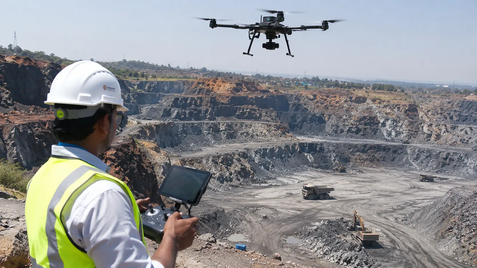
Accurate material measurement is essential for managing mining and quarry operations. Whether a company handles coal, iron ore, limestone, sand, gravel or construction aggregates, knowing the quantity of material available is important for inventory management, production planning and commercial reporting.
However, measuring large stockpiles can be challenging. Stockpiles often have irregular shapes, varying heights and changing surface conditions. Traditional measurement methods may require extensive fieldwork and can make it difficult to capture the complete surface of a large material pile.
Stockpile volume measurement using drone technology offers a modern approach to this challenge.
By capturing aerial images and generating detailed three-dimensional models, drones help survey teams calculate stockpile volumes and document material quantities. These measurements can be repeated periodically to monitor changes in inventory and support operational decisions.
In this article, we explore how stockpile volume calculation works, the technologies involved, its applications in mining and quarry operations, and how drone-based measurement can improve material management.
Need a stockpile survey? Explore Agmay's drone stockpile measurement and volumetric analysis services for mining, quarry and aggregate operations.
What Is Stockpile Volume Measurement?
Stockpile volume measurement is the process of calculating the three-dimensional volume of material stored in a pile.
Mining companies and quarry operators use this process to estimate the quantities of materials stored at different locations within their operational sites.
Common stockpiled materials include:
- Coal.
- Iron ore.
- Limestone.
- Bauxite.
- Granite.
- Sand.
- Gravel.
- Crushed stone.
- Construction aggregates.
The measured volume can be used alongside material density information to estimate the corresponding tonnage.
For example, if a stockpile has an estimated volume of 10,000 cubic metres and the assumed bulk density is 1.6 tonnes per cubic metre, the estimated material quantity is 16,000 tonnes.
The actual result depends on the material's bulk density, moisture content, compaction and measurement methodology.
Why Is Accurate Stockpile Measurement Important?
Stockpile measurements are not simply about knowing the size of a material pile. They support several important business and operational activities.
1. Inventory Management
Mining companies need updated information about the quantity of material available at different storage locations.
Regular stockpile measurements help inventory teams maintain records and compare material quantities over time.
2. Production Monitoring
Comparing stockpile measurements across different survey dates can help operators understand changes in stored material.
This information can support production tracking and operational reporting.
3. Material Dispatch and Planning
Stockpile quantities influence material handling, transportation and dispatch planning.
Updated measurements can help operational teams understand the available inventory before planning material movement.
4. Commercial Reconciliation
Material quantities can influence purchasing, selling, transportation and contractual reconciliation.
A consistent measurement process helps maintain documented records for commercial reviews.
5. Operational Reporting
Periodic stockpile surveys provide measurable records of material quantities at different points in time.
These records can support internal reporting and relevant audit or regulatory documentation.
How Does Drone Stockpile Volume Measurement Work?
Drone-based stockpile measurement uses aerial imagery or LiDAR data to reconstruct the surface of a material pile.
The resulting three-dimensional dataset is processed using specialised software to calculate its volume relative to a defined reference surface.
The process generally involves six stages.
Step 1: Survey Planning
The survey team identifies the stockpile locations, required accuracy, material types and measurement objectives.
Flight routes, camera settings, ground control requirements and data collection methods are planned according to site conditions.
Step 2: Drone Data Collection
A drone equipped with a high-resolution camera captures overlapping aerial images of the stockpile.
Alternatively, a suitable LiDAR-equipped drone can collect three-dimensional point cloud data.
The objective is to capture sufficient information about the stockpile surface and surrounding reference area.
Step 3: Image Processing and 3D Reconstruction
The collected images are processed using photogrammetry software to reconstruct the stockpile surface.
Depending on the survey method, the output may include:
- 3D point clouds.
- Digital Surface Models.
- Orthomosaic maps.
- Elevation datasets.
- Three-dimensional stockpile models.
Step 4: Reference Surface Selection
To calculate stockpile volume, the software needs a reference or base surface.
This may be an existing surveyed ground surface, a previously recorded surface or another agreed reference model.
Selecting the correct base surface is important because different reference surfaces can produce different volume calculations.
Step 5: Volume Calculation
The processed stockpile surface is compared with the reference surface.
The software calculates the volume between the two surfaces using its selected computational method.
The result is generally expressed in cubic metres.
Step 6: Reporting and Comparison
The final report can include individual stockpile volumes, total material volume, visual models and comparisons with previous surveys.
When repeated surveys use consistent control and measurement methods, the results can help track inventory changes over time.
Methods Used for Stockpile Volume Calculation
Different measurement methods can be used depending on stockpile size, site conditions and required outputs.
1. Drone Photogrammetry
Drone photogrammetry uses overlapping aerial photographs to reconstruct a three-dimensional representation of the stockpile.
It is commonly used for measuring open stockpiles at mines, quarries, aggregate yards and industrial facilities.
Its outputs can include orthomosaics, point clouds and digital surface models.
2. LiDAR Stockpile Measurement
LiDAR uses laser measurements to capture three-dimensional information about surfaces and structures.
A suitable LiDAR system can produce dense point clouds that represent stockpile geometry.
The method can be useful for projects requiring detailed surface information or where the site conditions favour LiDAR acquisition.
3. Ground-Based Surveying
Traditional methods use equipment such as total stations, GNSS receivers and other survey instruments to measure selected points across a stockpile.
These observations can be used to create a surface model and calculate material volume.
Ground-based surveying remains valuable for control measurements, validation and situations where aerial data collection is unsuitable.
4. Surface-to-Surface Comparison
For recurring stockpile monitoring, a new survey surface can be compared with an earlier reference surface.
This helps calculate changes between survey periods and identify areas where material has been added or removed.
The comparison is only meaningful when the datasets use compatible coordinate systems, reference surfaces and quality-control procedures.
Stockpile Volume Measurement Using Drones vs Traditional Methods
| Parameter | Traditional surveying | Drone-based surveying |
|---|---|---|
| Data collection | Ground measurements | Aerial imagery or LiDAR |
| Surface coverage | Selected measured points | Detailed surface reconstruction |
| Large stockpiles | Can require extensive fieldwork | Can capture broad surface areas |
| 3D visualisation | Requires additional modelling | Can generate 3D models |
| Repeated monitoring | Repeat ground surveys | Repeat aerial missions |
| Difficult access | May require physical access | Can capture selected areas remotely |
| Data outputs | Survey measurements and models | Point clouds, maps and surface models |
Drone surveys can complement conventional methods. The appropriate approach depends on the stockpile environment, measurement requirements and accuracy specifications.
Applications of Stockpile Measurement in Different Industries
Stockpile volume calculation is useful across several industries that store and manage bulk materials.
Coal Stockpile Measurement
Coal handling facilities and mining operations maintain large stockpiles for storage, processing and transportation.
Drone surveys can help measure coal stockpile volumes and document inventory changes across different survey periods.
Iron Ore Stockpile Measurement
Iron ore operations often maintain material stockpiles at mining sites, processing facilities and storage yards.
Three-dimensional volume measurement can support material inventory and production reporting.
Limestone Stockpile Measurement
Limestone quarries and cement manufacturing facilities handle significant quantities of raw material.
Periodic drone measurements can help monitor limestone inventory and material storage areas.
Sand and Aggregate Stockpile Measurement
Aggregate suppliers and quarry businesses maintain multiple piles of sand, gravel and crushed stone.
Drone-based measurement can help estimate individual pile volumes and maintain records across storage locations.
Industrial Material Storage
Other industrial facilities may use volumetric measurement for raw materials, processed materials and bulk storage areas.
The same underlying measurement techniques can be adapted to different site layouts and materials.
What Is the Difference Between Volume and Tonnage?
Volume and tonnage are two different measurements used in material inventory management.
Volume describes the three-dimensional space occupied by a stockpile. It is generally expressed in cubic metres.
Tonnage describes the mass of the material and is generally expressed in tonnes.
A drone survey primarily provides surface geometry and volume information. To estimate tonnage, the calculated volume must be combined with an appropriate bulk density value.
The basic calculation is:
Estimated Tonnage = Stockpile Volume × Bulk Density
For example:
| Measurement | Example value |
|---|---|
| Stockpile volume | 10,000 m³ |
| Assumed bulk density | 1.6 tonnes/m³ |
| Estimated tonnage | 16,000 tonnes |
This is an illustrative calculation, not a measurement of an actual stockpile.
For operational or commercial reporting, density assumptions should be appropriate to the material and its condition.
What Factors Affect Stockpile Measurement Accuracy?
The reliability of a stockpile volume calculation depends on several technical factors.
Survey Positioning
The positioning system and ground control methodology influence how accurately the collected data is placed within the project coordinate system.
Image Quality
Clear images, appropriate exposure and sufficient overlap are important for reliable photogrammetric reconstruction.
Stockpile Surface Conditions
Dust, shadows, reflective surfaces, vegetation and changing material conditions can affect data quality.
Reference Surface Accuracy
The selected base surface is one of the most important factors in calculating a meaningful volume.
Data Processing
Point cloud quality, surface reconstruction and volume calculation settings can influence the final output.
Survey Consistency
For repeated measurements, using consistent survey boundaries, control, processing methods and reference surfaces helps improve comparability.
A professional survey should document the measurement methodology and relevant limitations rather than presenting a volume figure without supporting information.
How Often Should Stockpiles Be Measured?
The appropriate measurement frequency depends on material movement and operational requirements.
Common approaches include:
- Weekly: For high-volume operations where stockpiles change rapidly.
- Monthly: For regular inventory updates and material reconciliation.
- Quarterly: For periodic operational reviews.
- Project-based: For stockpile verification before or after major material movements.
Mining companies can establish a recurring measurement schedule based on production rates, inventory requirements and applicable reporting obligations.
What Should a Stockpile Volume Report Include?
A useful stockpile survey report should provide more than a single volume figure.
Depending on the project requirements, a report may include:
- Project and survey details.
- Survey date and location.
- Stockpile identification.
- Coordinate reference system.
- Survey methodology.
- Reference or base surface information.
- Individual stockpile volume calculations.
- Total measured volume.
- Three-dimensional visualisation.
- Previous-survey comparison, where available.
- Quality-control information and measurement limitations.
Common digital outputs may include point clouds, orthomosaic imagery, digital surface models and CAD or GIS-compatible files.
The exact deliverables should be agreed before the survey begins.
Try a Stockpile Volume Calculator
A stockpile volume calculator can provide an initial estimate using simplified geometric measurements.
For example, a simplified calculation for a rectangular stockpile approximation is:
Volume = Length × Width × Average Height
If a stockpile is approximately 50 metres long, 30 metres wide and 5 metres high:
50 × 30 × 5 = 7,500 m³.
However, actual stockpiles rarely have perfect rectangular shapes. This simplified method should not be treated as a substitute for a three-dimensional survey when accurate operational measurements are required.
Drone photogrammetry and LiDAR provide a more detailed representation of irregular stockpile surfaces.
Drone Stockpile Measurement Services by Agmay Technologies
Agmay Technologies provides drone-based mining and geospatial solutions that support stockpile monitoring, volumetric analysis and digital site documentation.
Our approach combines aerial data acquisition, advanced mapping technologies and geospatial processing to help mining and quarry organisations understand their material inventory.
Our Stockpile Measurement Capabilities
Drone-Based Stockpile Survey
Aerial data collection for individual stockpiles and large material storage areas.
3D Stockpile Modelling
Generation of three-dimensional surface models from photogrammetry or suitable LiDAR datasets.
Volumetric Analysis
Processing and calculation of material volumes using defined reference surfaces.
Periodic Stockpile Monitoring
Repeated survey data collection to compare material quantities across different dates.
Mining and Quarry Mapping
Aerial mapping of stockpile areas, quarry sites, excavation zones and operational infrastructure.
Geospatial Reporting
Digital outputs and measurement information to support inventory reviews and operational reporting.
Why Choose Drone-Based Measurement with Agmay?
Mining and quarry organisations need consistent information about material quantities and changes in inventory.
Agmay combines drone technology with geospatial processing to support digital measurement workflows for mining and industrial applications.
Explore our Mining Industry Solutions to learn more about our drone-based mapping and volumetric capabilities.
Need accurate stockpile volumes?
Discuss your stockpile locations, material types, measurement frequency and reporting requirements with Agmay Technologies.
Explore Stockpile Survey Services ↗Conclusion
Stockpile volume measurement plays an important role in mining, quarry and industrial material management.
From coal and iron ore to limestone, sand and aggregates, accurate material volume information helps businesses maintain inventory records, monitor production and support operational planning.
Drone photogrammetry and LiDAR offer modern approaches to capturing stockpile surfaces and generating three-dimensional datasets for volumetric analysis.
By combining aerial data collection with consistent measurement methods and geospatial processing, organisations can establish more structured stockpile monitoring workflows.
Agmay Technologies supports mining and quarry organisations with drone-based mapping, volumetric analysis and geospatial solutions.
Discover how Agmay Technologies can support your stockpile and mining survey requirements.
Frequently Asked Questions
What is stockpile volume measurement?
Stockpile volume measurement is the process of calculating the three-dimensional volume of stored materials such as coal, iron ore, limestone, sand and aggregates.
How do you calculate stockpile volume?
Stockpile volume can be calculated by measuring the surface of the pile and comparing it with a defined reference surface. Drone photogrammetry, LiDAR and ground surveying can be used to collect the necessary data.
Can drones measure stockpile volumes?
Yes. Drones equipped with high-resolution cameras or LiDAR sensors can collect data to create three-dimensional stockpile models. These models can then be processed using specialised software to calculate volume.
What is the difference between stockpile volume and stockpile tonnage?
Volume measures the space occupied by a stockpile in cubic metres. Tonnage measures its mass in tonnes. Tonnage can be estimated by multiplying the measured volume by an appropriate bulk density.
How accurate is drone stockpile measurement?
Accuracy depends on the drone equipment, positioning, ground control, image quality, stockpile surface conditions, reference surface and processing methodology. Project-specific validation is important.
Which software is used for stockpile volume calculation?
Photogrammetry, point cloud processing and geospatial software can be used to generate stockpile surfaces and calculate volumes. The appropriate software depends on the data format and project requirements.
How often should stockpile surveys be conducted?
Stockpile surveys may be performed weekly, monthly, quarterly or according to operational requirements. High-volume material handling operations may need more frequent monitoring.
Can stockpile volume be converted into tonnes?
Yes. Multiply the calculated stockpile volume by the applicable bulk density. The density should account for the material type and its condition.
Who provides drone stockpile measurement services in India?
Agmay Technologies provides drone-based mapping, mining survey and volumetric analysis capabilities. Visit the Agmay mining services page to explore its solutions.