
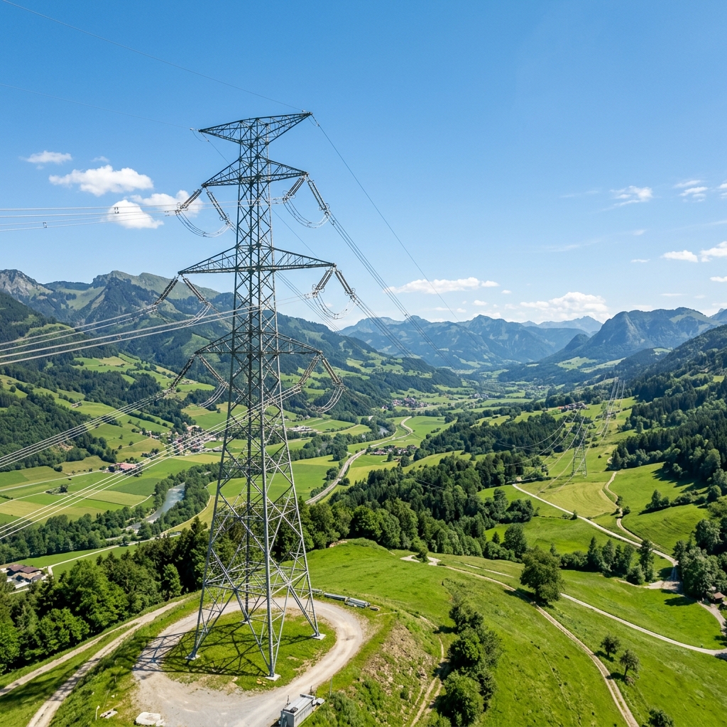
High-voltage transmission networks are essential to delivering electricity from generating stations to substations and distribution systems. Maintaining these networks requires regular inspection of transmission towers, conductors, insulators, connectors and surrounding power line corridors. Drone transmission line inspection uses unmanned aerial vehicles (UAVs) equipped with high-resolution cameras, thermal imaging sensors and advanced mapping technologies to assess the condition of high-voltage electricity infrastructure.
By capturing detailed aerial imagery and geospatial data, drone-based inspection helps transmission utilities identify visible infrastructure defects, investigate potential thermal anomalies and monitor environmental conditions around transmission corridors.
Modern inspection workflows can combine optical zoom cameras, radiometric thermal imaging, LiDAR mapping and AI-assisted image analysis to provide a more comprehensive view of transmission infrastructure.
For electricity transmission companies, grid operators, EPC contractors and infrastructure asset managers, these technologies offer an additional approach to monitoring extensive power networks and supporting maintenance planning.
Looking for a transmission inspection partner? Explore Agmay's drone electrical inspection services for high-voltage towers, conductors, thermal imaging and LiDAR corridor mapping.
What Is Drone Transmission Line Inspection?
Drone transmission line inspection is the process of using unmanned aerial vehicles to examine high-voltage overhead transmission infrastructure and collect visual, thermal and geospatial information about its condition.
Transmission lines extend across different geographical environments, including agricultural land, forests, mountains, industrial regions and remote areas. Accessing these structures through conventional inspection methods can involve significant logistical and operational challenges.
Drones provide an aerial inspection platform that can capture images of individual transmission structures and selected sections of the electricity corridor.
Depending on the inspection requirements, a drone-based transmission survey may include:
- High-voltage transmission tower inspection.
- Conductor and jumper inspection.
- Insulator string condition assessment.
- Cross-arm and tower hardware inspection.
- Connector and clamp inspection.
- Thermal imaging of electrical components.
- Vegetation encroachment assessment.
- Transmission corridor mapping.
- Geotagged asset documentation.
- AI-assisted defect identification.
The objective is to collect useful inspection information that helps engineering and maintenance teams evaluate infrastructure conditions.
Drone inspection complements established utility inspection programmes. It does not eliminate the need for ground patrols, tower-top inspections, electrical testing or other specialist assessment methods.
Why Is High-Voltage Transmission Line Inspection Important?
Transmission infrastructure operates under different environmental, mechanical and electrical stresses.
Over time, exposure to wind, rain, temperature variations, pollution, corrosion, vibration and other environmental conditions can contribute to the deterioration of infrastructure components.
A defect affecting an individual component may require investigation before it develops into a more significant operational concern.
Regular transmission line inspection helps utilities:
- Monitor the physical condition of transmission towers.
- Identify visible damage to insulators and conductors.
- Detect missing or deteriorating tower hardware.
- Investigate abnormal thermal patterns.
- Assess vegetation growth near transmission corridors.
- Maintain updated asset inspection records.
- Prioritise infrastructure requiring further examination.
- Support preventive and condition-based maintenance programmes.
The inspection frequency and methodology should be determined by the transmission asset owner according to applicable regulations, asset criticality, operating conditions and utility maintenance procedures.
How Drone Transmission Line Inspection Works
A professional drone transmission inspection programme involves several stages, from mission planning to engineering assessment and reporting.
1. Transmission Corridor Survey and Mission Planning
The first stage involves identifying the transmission infrastructure that requires inspection.
The inspection team reviews available utility records, tower locations, corridor maps, terrain information and operational requirements.
Planning considerations include:
- Transmission tower identification and locations.
- Line voltage and configuration.
- Terrain and environmental conditions.
- Access points and launch locations.
- Airspace restrictions and operational permissions.
- Electrical safety clearances.
- Required sensor capabilities.
- Image resolution and inspection coverage.
- Weather conditions and communication requirements.
The team then develops an inspection plan that defines the flight route, target assets, data collection requirements and operational safety procedures.
2. Aerial Inspection of Transmission Towers
Transmission towers support overhead conductors and associated electrical equipment. Their condition is important to the structural integrity of the transmission network.
Drones equipped with high-resolution cameras can capture images of tower structures from multiple viewing angles.
Inspection targets may include:
- Tower legs and structural members.
- Cross-arms and bracing.
- Bolted connections.
- Insulator attachment points.
- Suspension and tension hardware.
- Tower extensions.
- Corrosion and visible coating deterioration.
- Missing or displaced components.
Detailed aerial photographs provide inspection evidence that engineers can review without requiring a person to physically access every photographed component.
However, photographs alone cannot establish all structural conditions. Detailed engineering measurements and physical examinations may still be necessary.
3. Conductor and Jumper Inspection
Conductors carry electrical power between transmission structures. Their physical condition is important to the performance and reliability of overhead transmission networks.
Drone-based optical inspection can help examine:
- Visible conductor strand damage.
- Surface deterioration.
- Foreign objects.
- Damaged conductor fittings.
- Jumper connections.
- Spacers and vibration dampers.
- Visible abnormalities around suspension points.
High-resolution cameras with optical zoom can provide closer views of selected conductor sections and associated hardware.
Inspection quality depends on camera resolution, distance, image stability, lighting, viewing angle and environmental conditions.
Visual inspection should not be confused with electrical continuity testing or detailed conductor material assessment.
4. Insulator Inspection on Transmission Lines
Insulators electrically isolate energized conductors from grounded transmission tower structures while providing mechanical support.
Different transmission systems use suspension, tension and other insulator configurations depending on their design.
Drones can capture detailed images of insulator assemblies to help identify:
- Cracked or broken insulator units.
- Missing insulator discs.
- Visible contamination.
- Damaged end fittings.
- Displaced hardware.
- Foreign objects.
- Signs of physical deterioration.
High-resolution imagery can help engineers document the condition of insulator strings and identify components requiring closer examination.
Visual imagery cannot independently determine every electrical property of an insulator. Electrical testing and specialist diagnostic methods may be required where internal or electrical performance is in question.
5. Geospatial Inspection Reports and Maintenance Planning
The final stage involves processing the collected information and preparing inspection deliverables.
A structured transmission line inspection report can include:
- Transmission tower identification.
- Geotagged photographs.
- Annotated defect images.
- Component condition observations.
- Thermal inspection records.
- GIS-based corridor maps.
- LiDAR point-cloud datasets.
- Potential defect classifications.
- Maintenance investigation recommendations.
When integrated into an existing utility asset management system, these deliverables can support defect tracking, historical inspection comparisons and maintenance prioritisation.
The value of drone inspection comes not only from collecting aerial photographs but also from organising the information into a useful engineering and asset management workflow.
High-Voltage Transmission Line Inspection
Different transmission line components require different inspection perspectives and assessment methods. The table below summarises what aerial inspection can typically observe across a high-voltage network.
| Transmission component | Potential inspection findings |
|---|---|
| Transmission towers | Corrosion, damaged members and missing hardware |
| Insulator strings | Cracked units, missing discs and visible contamination |
| Conductors | Broken strands, physical damage and foreign objects |
| Jumper connections | Visible deterioration and abnormal thermal patterns |
| Suspension clamps | Physical damage and possible thermal anomalies |
| Tension hardware | Displacement, corrosion and visible deterioration |
| Vibration dampers | Missing or damaged components |
| Spacers | Displacement and visible damage |
| Cross-arms | Structural deterioration and damaged fittings |
| Tower foundations | Visible surface erosion and surrounding ground conditions |
| Transmission corridors | Vegetation encroachment and environmental changes |
The findings represent potential visual or sensor-based inspection observations. Some conditions require physical examination, electrical testing or detailed engineering verification.
Drone Inspection of Transmission Towers
Transmission towers are the structural backbone of an overhead line, and tower inspection is often the most detailed part of a drone survey programme.
Aerial imaging allows the inspection team to record the same tower from multiple angles and heights, producing a consistent set of views across the whole line rather than a few selected photographs.
Typical tower inspection observations include:
- Corrosion and coating deterioration on members and joints
- Missing, loose or displaced bolts and nuts
- Damaged or bent tower members and cross-arms
- Missing joint plates, step bolts and climbing accessories
- Insulator attachment points and suspension hardware
- Bird nests and other foreign objects on the structure
- Visible ground conditions and surface erosion around foundations
Geotagged tower photography also creates a historical visual record that can be compared against future inspections. Repeated tower imagery helps utilities see how a component has changed over time rather than relying on a single inspection snapshot.
Tower inspection findings should always be reviewed by qualified engineering personnel. Aerial photographs are strong evidence of visible condition, but structural adequacy and remaining service life require engineering assessment.
Thermal Imaging of Transmission Lines
Thermal inspection uses infrared cameras to capture temperature-related information from electrical equipment.
During appropriate operating conditions, thermal imaging can help identify abnormal temperature patterns in selected transmission components.
Potential inspection targets include:
- Connectors and clamps.
- Jumper connections.
- Terminal connections.
- Selected electrical fittings.
- Associated substation interfaces.
Radiometric thermal cameras provide temperature-related measurements that can support further investigation.
Thermal interpretation must account for:
- Electrical load at the time of inspection.
- Ambient temperature.
- Wind and weather conditions.
- Surface emissivity.
- Reflected radiation.
- Camera calibration.
- Viewing angle and distance.
- Equipment operating characteristics.
An observed temperature difference does not automatically confirm an electrical defect. Thermal findings should be assessed by qualified personnel using appropriate measurement and engineering procedures.
LiDAR Transmission Corridor Mapping
Transmission lines frequently cross forests, agricultural land, uneven terrain and other environments where vegetation and terrain can affect corridor management.
LiDAR (Light Detection and Ranging) provides three-dimensional spatial information by measuring laser returns from surrounding objects and surfaces.
When combined with suitable positioning systems and processing workflows, aerial LiDAR surveys can support:
- Transmission corridor mapping.
- Vegetation proximity assessment.
- Three-dimensional terrain modelling.
- Power line spatial modelling.
- Right-of-way monitoring.
- Asset location documentation.
- Clearance analysis against specified engineering criteria.
LiDAR point clouds can help identify the spatial relationships between conductors, vegetation, towers and surrounding terrain.
This is particularly useful when utilities require a more detailed understanding of corridor conditions than conventional two-dimensional photographs can provide.
Actual clearance assessment depends on survey quality, positioning, point-cloud classification, conductor operating conditions and the applicable engineering criteria.
AI-Assisted Transmission Line Defect Identification
Drone inspections can produce thousands of photographs across large transmission networks.
Artificial intelligence and computer vision can assist engineers by processing images and identifying components or potential abnormalities.
Depending on the training data and validated detection models, AI-assisted inspection can support the identification of:
- Insulator damage.
- Missing tower hardware.
- Corrosion patterns.
- Conductor abnormalities.
- Damaged fittings.
- Foreign objects.
- Vegetation encroachment.
- Structural irregularities.
Detected objects and potential defects can be tagged with geographic information and organised for engineering review.
AI detection results should be treated as inspection indicators rather than final engineering diagnoses. Human verification remains important, especially when findings influence infrastructure maintenance or operational decisions.
Technologies Used in Drone Transmission Line Inspection
Selecting the appropriate drone platform and sensor configuration is essential for obtaining useful transmission inspection data.
High-Resolution RGB Cameras
RGB cameras capture visible-light photographs of transmission structures and electrical components.
They are commonly used for examining physical defects, missing hardware, corrosion, damaged insulators and conductor conditions.
Optical Zoom Cameras
Optical zoom cameras allow inspection teams to capture detailed photographs of distant components.
They are particularly useful for examining insulator strings, tower fittings, connectors and other small components without relying entirely on close physical access.
Radiometric Thermal Cameras
Radiometric thermal cameras capture infrared data that can be used to assess temperature patterns across selected electrical components.
They support condition monitoring by highlighting potential hotspots that require further investigation.
LiDAR Sensors
LiDAR sensors collect three-dimensional spatial information about transmission corridors.
The resulting datasets can support terrain modelling, vegetation assessment, conductor mapping and clearance analysis.
GNSS and RTK Positioning
Global Navigation Satellite Systems and Real-Time Kinematic positioning technologies can support geospatial tagging, transmission tower mapping and the positioning of inspection datasets.
Actual positioning accuracy depends on the positioning system, correction data, satellite visibility and processing methodology.
Artificial Intelligence and GIS Platforms
AI-assisted image analysis helps organise large inspection datasets and identify potential defects.
GIS platforms provide the spatial environment for visualising transmission infrastructure, inspection locations, corridor information and maintenance findings.
Benefits of Drone Transmission Line Inspection
Drone-based transmission inspection can provide several operational advantages when integrated into an appropriate utility maintenance programme.
1. Reduced Requirement for Difficult Physical Access
Transmission towers can be located in remote or challenging terrain.
Aerial image acquisition provides an alternative method for examining selected tower components without requiring personnel to physically access every inspection point.
This can reduce exposure to certain working-at-height hazards, although other operational risks remain.
2. Improved Inspection Visibility
Drones can capture multiple perspectives of transmission towers, conductors and associated electrical equipment.
High-resolution imagery helps engineers examine components that may be difficult to observe through ground-level inspections.
3. Digital Inspection Records
Geotagged images and structured inspection datasets provide digital records of infrastructure conditions.
These records can support future comparisons and maintenance documentation.
4. Better Corridor Monitoring
Aerial surveys can cover selected transmission corridors and collect information about surrounding vegetation and terrain.
When combined with LiDAR, the inspection process can provide three-dimensional information for corridor management.
5. Support for Condition-Based Maintenance
Inspection findings can be classified and organised according to asset location and observed condition.
This helps maintenance teams identify assets requiring additional investigation and allocate inspection resources more effectively.
6. Integration of Multiple Inspection Technologies
A single inspection programme can combine optical imaging, thermal inspection, LiDAR and GIS-based reporting.
This provides different types of information about the same transmission infrastructure and supports more comprehensive asset assessment.
Drone Inspection vs Traditional Transmission Line Inspection
Traditional transmission line inspection methods include ground patrols, tower climbing, helicopter-based surveys, specialised equipment and other utility-approved techniques.
Drone inspection adds another data acquisition option.
| Inspection factor | Traditional methods | Drone-based methods |
|---|---|---|
| Tower inspection | Ground observation or physical access | Aerial multi-angle photography |
| Component visibility | Depends on access and inspection method | High-resolution aerial imagery |
| Thermal inspection | Requires suitable thermal equipment | Can integrate aerial thermal sensors |
| Corridor assessment | Separate surveying methods may be used | Can integrate aerial LiDAR |
| Data collection | Manual or equipment-based records | Digital photographs and sensor datasets |
| Geospatial documentation | Depends on survey workflow | Can integrate GNSS and GIS |
| Defect identification | Engineer-led inspection | Engineer review with optional AI assistance |
| Maintenance planning | Based on inspection findings | Can integrate structured digital reports |
Neither approach is suitable for every inspection requirement.
Transmission utilities should select inspection methods according to voltage level, asset condition, operational risk, terrain, regulatory requirements and maintenance objectives.
Can Drones Inspect Energized High-Voltage Transmission Lines?
Drones may be used to collect visual and thermal inspection data near energized transmission infrastructure, provided the operation is specifically planned, authorised and conducted using suitable equipment and appropriate electrical safety controls.
However, high-voltage environments introduce significant operational considerations.
Inspection planning must address:
- Electrical approach distances.
- Voltage level and line configuration.
- Drone positioning and navigation reliability.
- Electromagnetic interference.
- Potential electrical discharge.
- Wind and environmental conditions.
- Flight permissions and airspace restrictions.
- Communication reliability.
- Utility-specific electrical safety procedures.
The electrical field around high-voltage equipment can affect certain electronic systems, including navigation and sensing equipment, depending on the operating environment and equipment design.
An aerial inspection does not mean that a drone can safely touch or manipulate an energized conductor.
Similarly, a drone inspection near energized lines should not be confused with live-line maintenance or direct electrical testing.
The transmission asset owner and drone operator must establish suitable operational controls and confirm that the planned flight is permitted.
Drone Transmission Line Inspection in India
India has an extensive electricity transmission infrastructure connecting generating stations, substations, industrial centres and distribution networks.
The expansion of renewable energy generation, inter-state transmission infrastructure and electricity demand increases the importance of systematic infrastructure monitoring.
Drone-based transmission inspection can support utilities in assessing:
- Inter-state transmission corridors.
- High-voltage transmission towers.
- Renewable energy evacuation lines.
- Remote transmission infrastructure.
- Industrial transmission connections.
- Vegetation along power corridors.
- Transmission infrastructure in challenging terrain.
Regulatory and Operational Considerations in India
Commercial drone operations in India are governed by the applicable aviation regulations, including the Drone Rules, 2021 and subsequent amendments.
Before conducting an inspection, operators must assess the applicable requirements concerning:
- Drone classification and registration.
- Applicable certification requirements.
- Remote pilot qualifications.
- Airspace zone classification.
- Flight permissions.
- Operational restrictions.
- Privacy and other applicable legal requirements.
The Digital Sky platform provides relevant airspace information.
DGCA guidance also specifies important operational restrictions, including requirements concerning visual line of sight and approvals for applicable restricted airspace operations.
Transmission inspection operators must additionally comply with the electricity utility's site-specific electrical safety requirements.
It is important to distinguish aviation permissions from electrical safety authorisation. Obtaining permission to fly a drone does not automatically authorise an operation near energized transmission infrastructure.
Indian Electricity Infrastructure Inspection Requirements
The Central Electricity Authority (CEA) provides regulatory requirements and guidance relating to electricity transmission infrastructure.
The CEA's regulatory framework includes provisions for overhead-line patrolling, with schedules determined by transmission licensees according to normal, vulnerable and most vulnerable terrain.
Ground inspection of live lines and tower-top inspection of de-energised lines are addressed separately.
Drone surveys can provide supplementary inspection information, but they should not automatically be treated as substitutes for the utility's prescribed inspection and maintenance procedures.
How Often Should Transmission Lines Be Inspected?
Transmission line inspection frequency depends on the applicable regulatory framework, utility maintenance procedures, asset criticality, environmental exposure and historical condition information.
Factors that may influence inspection frequency include:
- Transmission voltage and network importance.
- Age and physical condition of infrastructure.
- Coastal and high-corrosion environments.
- High-wind and storm-prone regions.
- Vegetation growth patterns.
- Historical equipment failures.
- Terrain accessibility.
- Operational risk assessments.
Transmission utilities should establish inspection schedules based on applicable CEA requirements and their approved maintenance procedures.
Drone-based inspections can be incorporated into these programmes to support additional visual surveys, targeted condition assessments and corridor monitoring.
Applications of Drone Transmission Line Inspection Across Industries
Drone transmission inspection is relevant to organisations responsible for developing, operating and maintaining electricity infrastructure.
Electricity Transmission Companies
Transmission utilities can use aerial inspection data to document tower conditions, assess conductor hardware and monitor transmission corridors.
Power Grid Operators
Grid operators can use structured inspection records to support infrastructure monitoring and maintenance coordination.
Renewable Energy Developers
Solar, wind and other renewable energy projects may require transmission infrastructure to connect generation facilities to the electricity grid.
Drone inspection can support the monitoring of selected evacuation corridors and associated infrastructure.
EPC Contractors
Engineering, procurement and construction contractors can use aerial survey information for infrastructure documentation, construction monitoring and inspection support.
Industrial Infrastructure Operators
Large industrial facilities may operate dedicated high-voltage transmission connections and electrical infrastructure that require periodic condition assessment.
Drone Transmission Line Inspection Services by Agmay Technologies
Agmay Technologies provides drone-based electrical infrastructure inspection solutions designed to support transmission networks, distribution systems and utility infrastructure.
Our transmission inspection approach combines aerial data acquisition with optical imaging, thermal inspection, LiDAR mapping and AI-assisted analysis.
Our Capabilities
High-Voltage Transmission Line Inspection
Aerial visual assessment of transmission towers, conductors, insulators, connectors and associated hardware.
Transmission Tower Condition Assessment
High-resolution imaging to document visible corrosion, damaged tower members, missing fittings and other structural abnormalities.
Thermal Inspection
Radiometric thermal imaging to examine temperature patterns and identify potential hotspots requiring further investigation.
LiDAR Transmission Corridor Mapping
Three-dimensional corridor mapping to support vegetation assessment, spatial infrastructure modelling and clearance analysis.
AI-Assisted Defect Identification
Computer vision-assisted analysis to identify and organise potential infrastructure defects for engineering review.
GIS Mapping and Digital Reporting
Geotagged inspection photographs, spatial asset records, inspection findings and structured digital deliverables.
Agmay's electrical inspection solutions are designed to help utilities and infrastructure operators collect structured inspection information and support maintenance planning.
Looking for drone electrical inspection services?
Whether you manage high-voltage transmission corridors, renewable energy evacuation lines, industrial power infrastructure or utility assets, we can help define a suitable aerial inspection programme.
Explore Drone Electrical Inspection Services ↗Explore our drone electrical inspection services to learn more about our transmission inspection, thermal imaging, LiDAR mapping and geospatial reporting capabilities. You can also read the broader guide to drone electrical inspection and our article on drone power line inspection.
Frequently Asked Questions About Drone Transmission Line Inspection
1. What is drone transmission line inspection?
Drone transmission line inspection is the use of unmanned aerial vehicles equipped with cameras and specialised sensors to examine high-voltage transmission towers, conductors, insulators and associated infrastructure.
2. How do drones inspect high-voltage transmission lines?
Drones follow planned inspection routes and capture high-resolution photographs, thermal imagery and, where required, LiDAR datasets. The collected information is processed and reviewed to identify potential defects and document asset conditions.
3. What defects can drones detect on transmission towers?
Drones can help identify visible corrosion, damaged tower members, missing hardware, displaced fittings, cracked insulators, damaged conductors and foreign objects.
4. Can drones inspect 220 kV, 400 kV and 765 kV transmission lines?
Drone platforms can be used to collect inspection data around different high-voltage transmission configurations, subject to equipment suitability, operational permissions and electrical safety requirements. The appropriate drone and sensor configuration must be assessed for each project.
5. Can drones inspect energized transmission lines?
Certain visual and thermal inspections can be conducted near energized transmission infrastructure when properly planned and authorised. The operation must follow appropriate electrical clearances, equipment requirements and utility safety procedures.
6. What sensors are used for transmission line drone inspection?
Common sensors include high-resolution RGB cameras, optical zoom cameras, radiometric thermal cameras and LiDAR sensors. GNSS and RTK positioning can support geospatial documentation.
7. How is thermal imaging used in transmission line inspection?
Thermal imaging captures temperature-related information from selected electrical components. It can help identify abnormal temperature patterns in connectors, clamps and associated equipment that may require further investigation.
8. Can drones detect damaged transmission line insulators?
High-resolution aerial imagery can help identify visible cracks, broken insulator units, missing discs, contamination and physical damage. Electrical performance and internal defects may require additional testing.
9. What is the role of LiDAR in transmission line inspection?
LiDAR creates three-dimensional spatial datasets that can support corridor mapping, vegetation proximity assessment, terrain modelling and clearance analysis.
10. Can AI automatically identify transmission line defects?
AI-assisted computer vision can help identify potential defects in inspection imagery, including damaged insulators, missing hardware and corrosion patterns. Important findings require engineering verification.
11. Are drone transmission line inspections permitted in India?
Drone operations in India are governed by the Drone Rules, 2021 and applicable amendments. Operators must assess the relevant registration, certification, pilot, airspace and operational requirements before deployment.
12. How often should high-voltage transmission lines be inspected?
Inspection frequency depends on the applicable regulatory requirements, utility maintenance procedures, terrain, environmental exposure, asset condition and operational risk. Transmission licensees establish appropriate inspection schedules.
13. What is the difference between transmission line inspection and distribution line inspection?
Transmission line inspection focuses on high-voltage infrastructure that transports electricity over longer distances between substations and major grid connections. Distribution line inspection focuses on the networks that deliver electricity from substations towards consumers.
14. Who needs drone transmission line inspection services?
Electricity transmission companies, grid operators, EPC contractors, renewable energy developers, industrial infrastructure owners and power utilities can benefit from suitable drone-based transmission inspection programmes.
Conclusion
Drone transmission line inspection provides electricity utilities with an additional method of assessing high-voltage infrastructure through aerial imaging, thermal sensing, LiDAR mapping and AI-assisted data analysis.
By capturing detailed information about transmission towers, conductors, insulators and surrounding corridors, drone-based surveys can support infrastructure condition monitoring, defect documentation and maintenance planning.
The greatest value comes from integrating aerial inspection data into a structured engineering and asset management workflow rather than treating drone deployment as an isolated photography exercise.
For transmission companies and infrastructure operators looking to improve the visibility of their electricity networks, drone-based inspection offers a valuable addition to established maintenance programmes.
Agmay Technologies delivers drone-based electrical inspection, thermal imaging, LiDAR corridor mapping and geospatial reporting solutions to support modern electricity infrastructure monitoring. Explore Agmay Electrical Inspection Services.