
Advanced UAVs
Hybrid Fixed-Wing VTOL
Agmay AeroVTOL-X
Vertical takeoff with pusher fixed-wing cruise for 50+ km corridor mapping & surveillance
- Capacity
- 50+ km Range
- Payload
- 2.5 kg
- Flight time
- 90 - 120 minutes
DGCA-authorised RPTO No. 23/2025 · Designed and built in India
Drone services · Survey and mapping
Long-endurance corridor mapping for highways, railway alignments, canals and river basins, without closing a lane or putting a chain-survey team beside traffic. Long corridors are flown in sections that keep the aircraft within the pilot’s sight; flying beyond visual line of sight needs a specific DGCA authorisation.
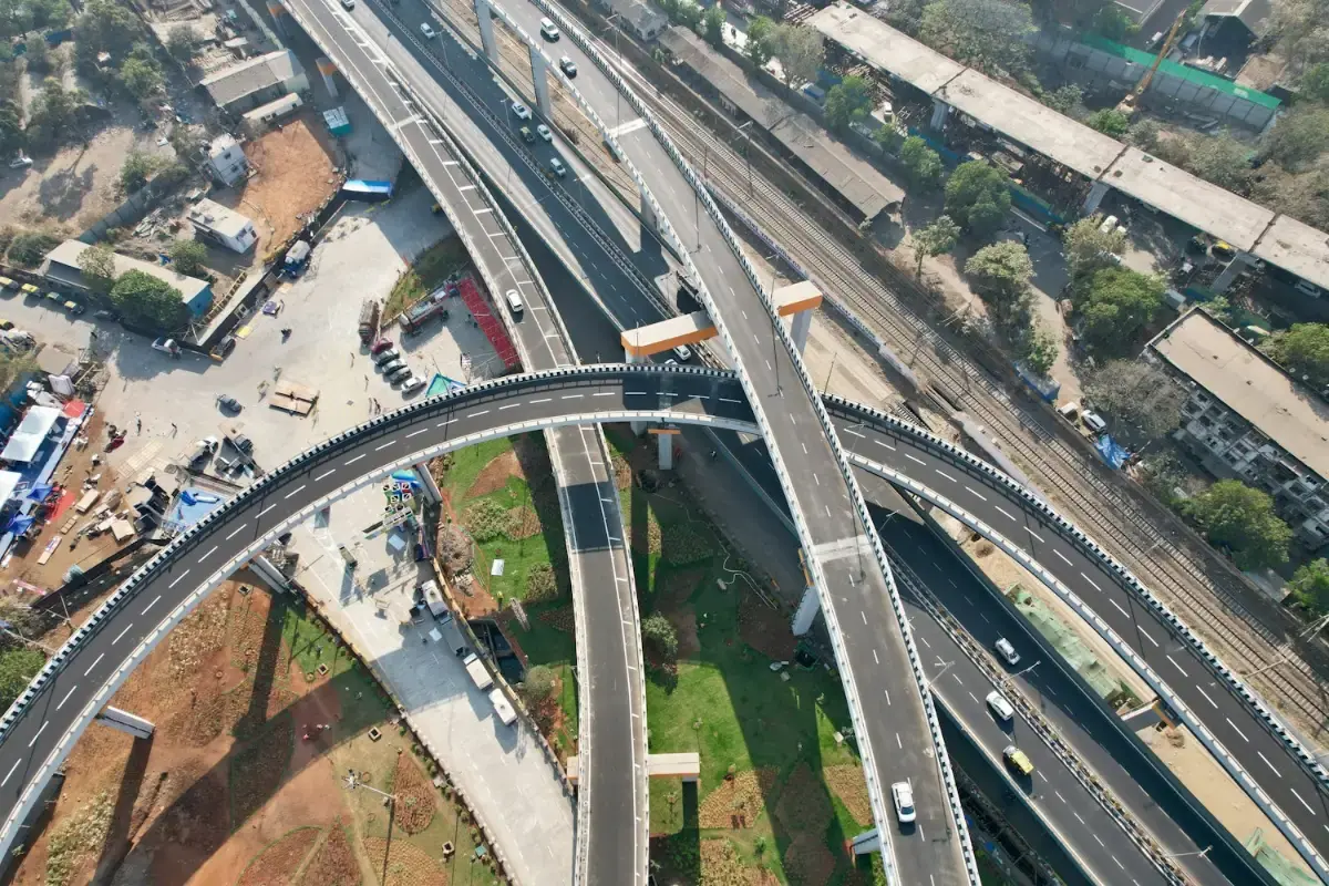
Why use drones
Comparison
Figures from our standard operating procedures and completed projects.
Lane closures
Agmay droneNone
Ground chain surveyRequired for survey teams
Runway or launch site
Agmay droneNone: vertical take-off from any clearing
Ground chain surveyNot applicable
Output
Agmay droneContinuous orthomosaic, DSM/DTM and cross-sections
Ground chain surveyCross-sections at intervals
| Measure | Agmay drone | Ground chain survey |
|---|---|---|
| Lane closures | None | Required for survey teams |
| Runway or launch site | None: vertical take-off from any clearing | Not applicable |
| Output | Continuous orthomosaic, DSM/DTM and cross-sections | Cross-sections at intervals |
Applications

Right-of-way mapping, cut-and-fill volumes and cross-sections.
Contours and embankment condition along the full command area.
Base mapping for new lines, doubling and yard remodelling.

Up-to-date imagery for planning and encroachment checks.
Outputs
Every corridor project is delivered in standard formats for engineering, GIS and planning software.
Orthomosaic
GeoTIFF
True-scale aerial image of the whole corridor for measurement and planning
Elevation models
DSM and DTM (GeoTIFF)
Surface and bare-ground heights for levels, cut and fill
Contours and cross-sections
DXF, DWG
Drawings ready for AutoCAD and civil design software
Point cloud
LAS, LAZ
Millions of measured points from photogrammetry or LiDAR
3D model
OBJ, 3D tiles
Textured model of structures, junctions and terrain
GIS layers
SHP, KML, GeoPackage
Features and boundaries for QGIS, ArcGIS or Google Earth
| Deliverable | Format | Used for |
|---|---|---|
| Orthomosaic | GeoTIFF | True-scale aerial image of the whole corridor for measurement and planning |
| Elevation models | DSM and DTM (GeoTIFF) | Surface and bare-ground heights for levels, cut and fill |
| Contours and cross-sections | DXF, DWG | Drawings ready for AutoCAD and civil design software |
| Point cloud | LAS, LAZ | Millions of measured points from photogrammetry or LiDAR |
| 3D model | OBJ, 3D tiles | Textured model of structures, junctions and terrain |
| GIS layers | SHP, KML, GeoPackage | Features and boundaries for QGIS, ArcGIS or Google Earth |
How it works
We agree the site boundary, outputs, accuracy and schedule, and visit or review the site on maps.
Airspace is checked on Digital Sky, permissions are arranged where needed and the flight plan is loaded.
A certified crew flies the mission with the right aircraft and sensor, and checks the data on site.
Data is processed, checked against control points or references and reviewed by a second person.
You receive the agreed files and a short walkthrough, with support for follow-up questions.
Track record
Telangana state highway corridor
Right-of-way asset mapping, bridge approaches and vegetation encroachment along an 85 km corridor.
1.8 cm GSD orthomosaic delivered with full road cross-sections.
Equipment: Agmay AeroVTOL-X (fixed-wing VTOL)
Godavari basin irrigation command area
High-resolution contour mapping and embankment stability analysis along 120 km of canals.
14 critical embankment breaches identified before the monsoon.
Equipment: Agmay AeroVTOL-X and DJI M400
Deliverables
Hybrid Fixed-Wing VTOL
Vertical takeoff with pusher fixed-wing cruise for 50+ km corridor mapping & surveillance
Heavy Enterprise Flagship
Heavy-duty enterprise workhorse with up to 59 minutes of flight, a 6 kg payload, LiDAR and mmWave radar…
High-Precision Aerial LiDAR
Long-range 1535 nm aerial LiDAR with dual 100MP mapping cameras for the DJI Matrice 400
FAQ
Related
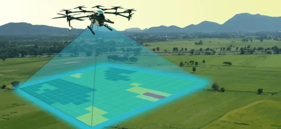
Aerial photogrammetry with DGPS ground control for cadastral boundaries, housing schemes, industrial estates and town planning. A drone covers in a…
1,000+ acres mapped in a working day
Explore the service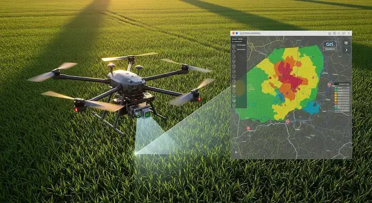
We turn drone and satellite data into GIS layers people can use: classified land-use maps, property and asset databases, crop-health analysis and…
24,000+ properties geo-tagged in one municipal project
Explore the service
Track, bridges, tunnels, overhead electrification and stations inspected from the air with RTK positioning, LiDAR and thermal imaging. Flights are…
50 km of track captured in one project
Explore the serviceEnquiry
Share a few details and the right person from our team will get back to you with a plan and a quotation.
Monday to Saturday, 9:00 am – 6:30 pm