
Advanced UAVs
Hybrid Fixed-Wing VTOL
Agmay AeroVTOL-X
Vertical takeoff with pusher fixed-wing cruise for 50+ km corridor mapping & surveillance
- Capacity
- 50+ km Range
- Payload
- 2.5 kg
- Flight time
- 90 - 120 minutes
DGCA-authorised RPTO No. 23/2025 · Designed and built in India
Drone services · Inspection
Track, bridges, tunnels, overhead electrification and stations inspected from the air with RTK positioning, LiDAR and thermal imaging. Flights are planned at a safe stand-off from the line, so trains keep running.

Why use drones
Comparison
Figures from our standard operating procedures and completed projects.
Track possession
Agmay droneNo block needed
Foot patrolStaff on or beside the track
Position of each finding
Agmay droneRTK coordinates to about 2 cm
Foot patrolKilometre post and notes
Bridges, tunnels and OHE
Agmay droneImaged, scanned and thermally checked
Foot patrolHard to reach
| Measure | Agmay drone | Foot patrol |
|---|---|---|
| Track possession | No block needed | Staff on or beside the track |
| Position of each finding | RTK coordinates to about 2 cm | Kilometre post and notes |
| Bridges, tunnels and OHE | Imaged, scanned and thermally checked | Hard to reach |
Applications
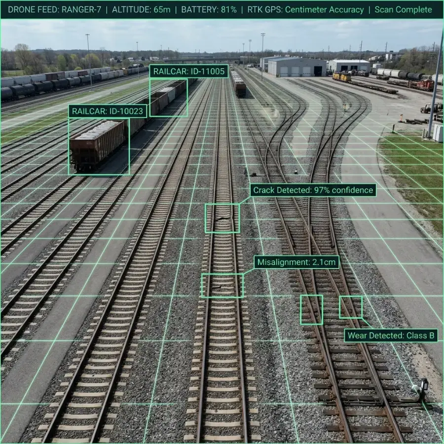
Rails, sleepers, fastenings and ballast imaged at high resolution.
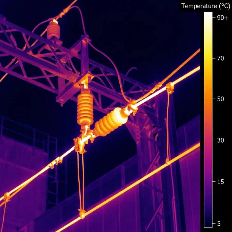
Catenary, droppers and insulators checked for hot joints and sag.
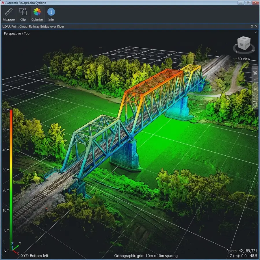
LiDAR and photogrammetry models of structures that are hard to access.
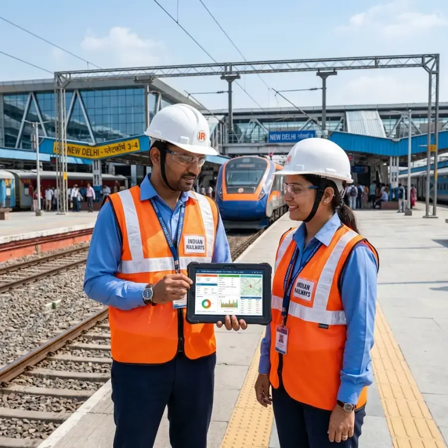
Findings filtered and assigned from a GIS dashboard.
How it works
Section limits, traffic pattern and safety rules are agreed with the railway engineers.
Multirotor and VTOL aircraft capture imagery, thermal and LiDAR along the line.
Data is processed into orthomosaics and point clouds, and defects are classified by priority.
Findings are loaded to a GIS dashboard with coordinates and images.
Engineering summaries and work tickets go to the maintenance teams.
Deliverables
Hybrid Fixed-Wing VTOL
Vertical takeoff with pusher fixed-wing cruise for 50+ km corridor mapping & surveillance
Heavy Enterprise Flagship
Heavy-duty enterprise workhorse with up to 59 minutes of flight, a 6 kg payload, LiDAR and mmWave radar…
Tactical Thermal Enterprise
Compact enterprise drone with 640×512 thermal, three 48MP cameras, 112× hybrid zoom & an 1,800 m laser…
FAQ
Related
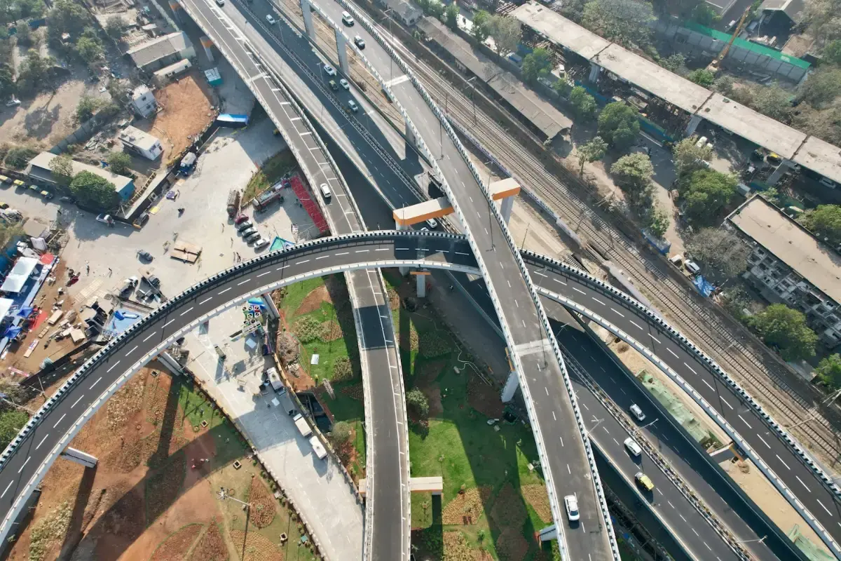
Long-endurance corridor mapping for highways, railway alignments, canals and river basins, without closing a lane or putting a chain-survey team…
1,200+ linear kilometres mapped
Explore the service
Visual and radiometric thermal inspection of towers, turbines, solar plants, stacks and structures while they stay in service. High zoom shows the…
1,500+ utility assets inspected
Explore the service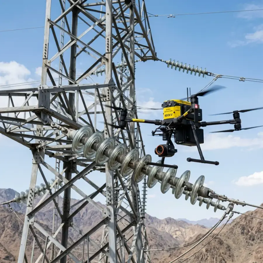
Electrical networks run for thousands of kilometres, and inspecting them on foot or by climbing is slow and hazardous. We inspect transmission…
765 kV corridors inspected up to this voltage class
Explore the serviceEnquiry
Share a few details and the right person from our team will get back to you with a plan and a quotation.
Monday to Saturday, 9:00 am – 6:30 pm